ShopDreamUp AI ArtDreamUp
Deviation Actions


Description
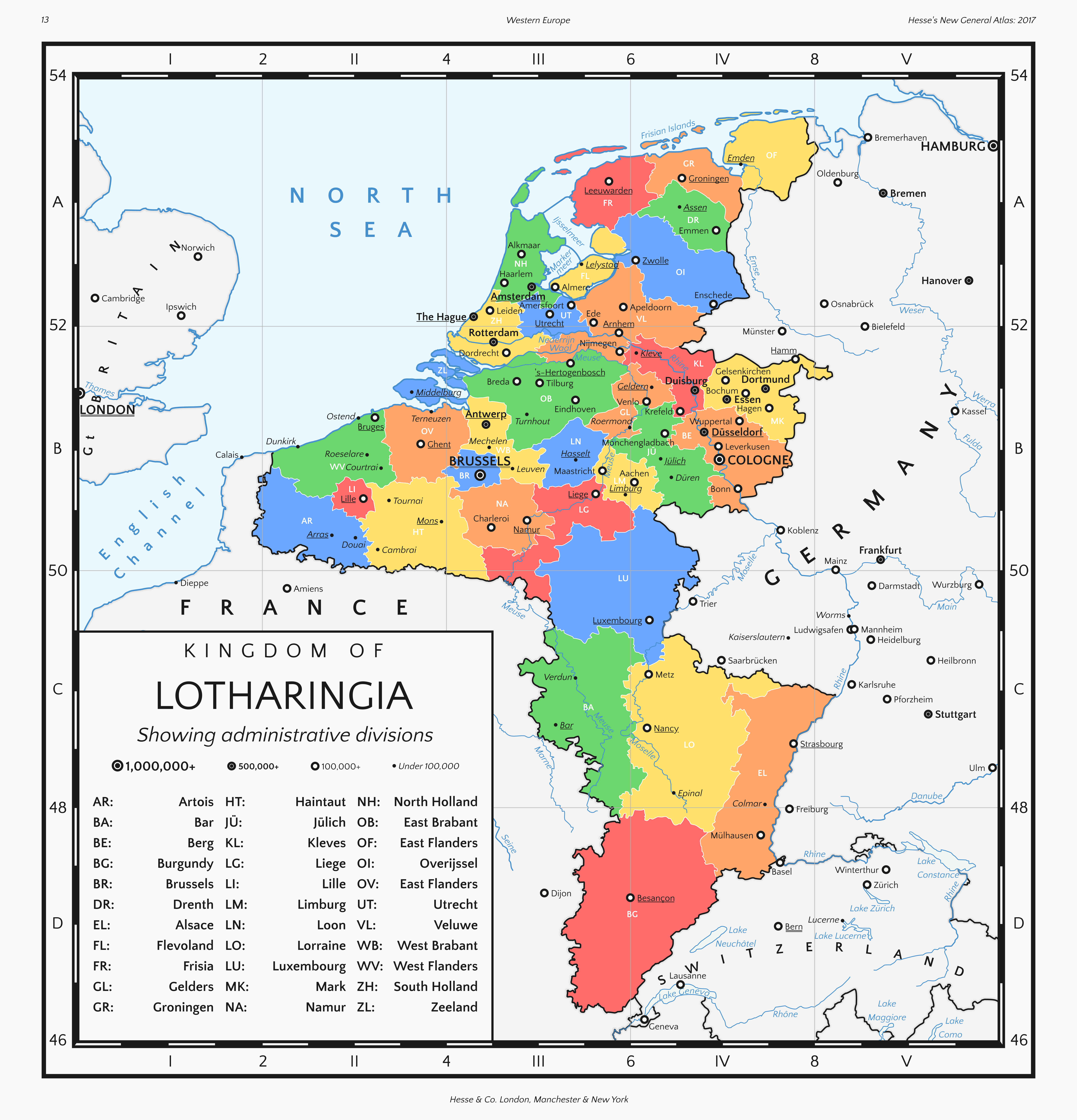
A map from my Kingdom of Lotharingia series showing the present day situation.
In the 1960s, the administrative subdivisions of the Kingdom of Lotharingia were re-organised, with many traditional provinces disappearing and new ones being created. The most recent change to take place was the creation of the province of Brussels, which was separated from West Brabant in the 1980s.
The province of Burgundy is the largest, Berg is the most populous and has the largest economy, and Brussels is the most densely populated and has the highest GDP per capita.
I also made a historical map, demographic map, flag, coat of arms, collection of emblems, Wikipedia-style country info-box, and a legislative map and info-box for this series.
Image size
6143x6391px 3.59 MB
© 2017 - 2024 HouseOfHesse
Comments15
Join the community to add your comment. Already a deviant? Log In
Your usage of color is green so provinces on green color